
As a scientist working in First Nations territory in southwest British Columbia, I have come to deeply value the knowledge embedded in Indigenous oral histories. That respect deepened profoundly when a centuries-old Líl̓wat account converged—precisely and independently—with quantitative measurements derived from my own geological fieldwork.
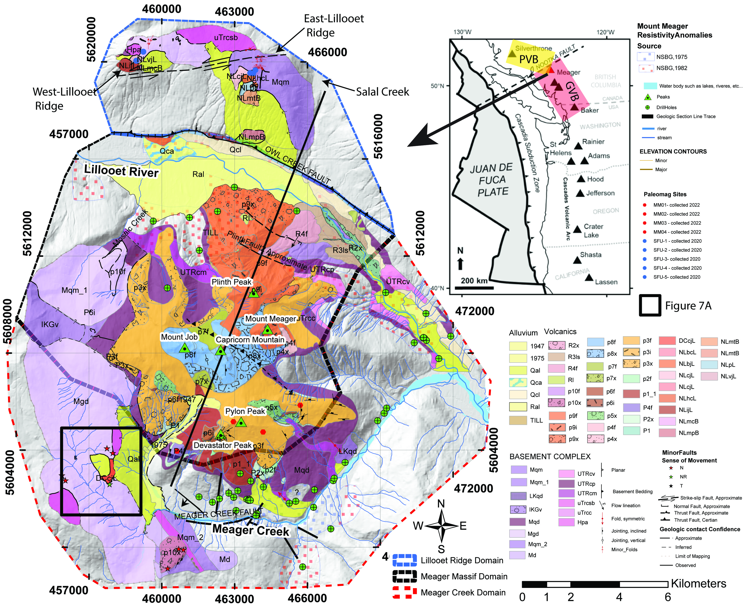
Between 2019 and 2023, I conducted detailed geological mapping of the Mount Meager Volcanic Complex (Qwélqwélústen) as part of my PhD research. This work culminated in a peer-reviewed publication (Muhammad et al., 2024) demonstrating that the volcanic edifice has lost at least one kilometre of elevation. That reduction reflects the cumulative effects of tectonic deformation, volcanic construction and destruction, and repeated large-scale landslides that have progressively reshaped the mountain over Quaternary time.
A testable statement preserved in oral tradition
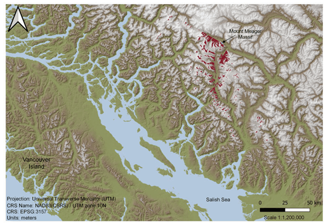
Within Líl̓wat oral history is a statement that climbers could once see the ocean from the summit of Qwélqwélústen. Rather than interpreting this as metaphor, recent interdisciplinary work framed it as a testable geomorphic and topographic claim—one that can be evaluated using modern viewshed analysis and structural reconstruction.
Why this convergence matters
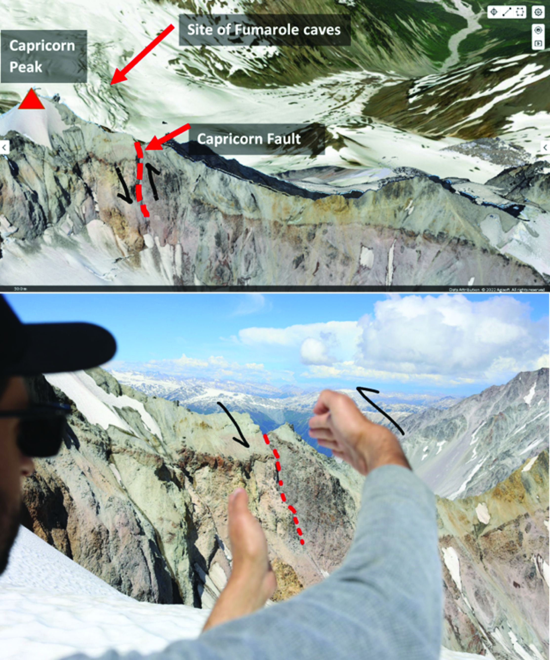
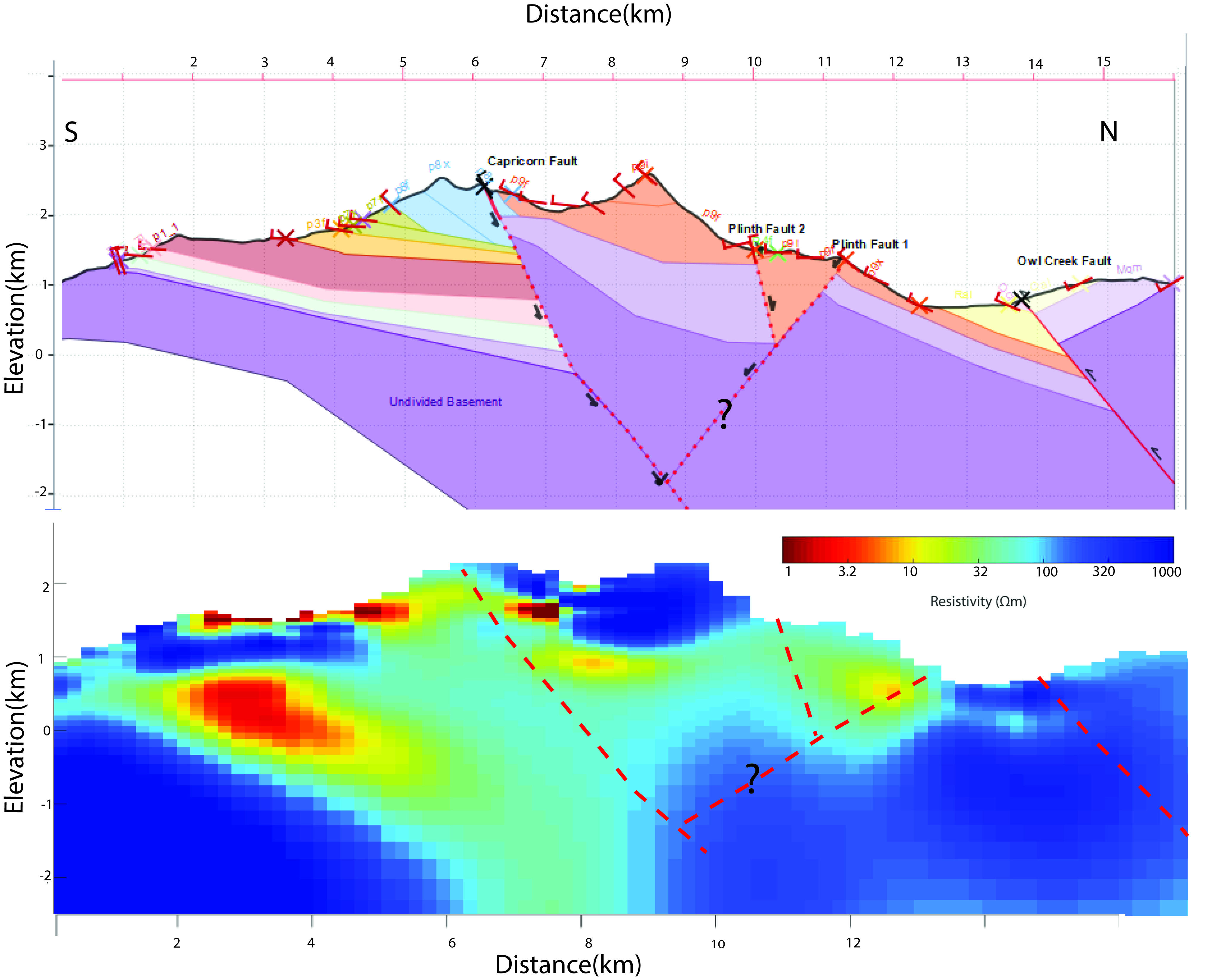
My confidence in the geological interpretation rests on mapped fault networks, kinematics consistent with restraining-bend deformation, paleomagnetic tilt data, and unmistakable geomorphic evidence of large-scale mass wasting. Yet seeing these independent observations converge with a Líl̓wat oral narrative—encoded, preserved, and transmitted across generations—was profoundly moving in a way no stereonet or cross-section alone can capture.
- Structural geology: Fault-controlled uplift and exhumation removed volcanic sequences on the order of ~1 km.
- Oral history and viewshed analysis: Ocean visibility is restored when summit elevation is increased by ~950–1000 m, consistent with geological reconstruction.
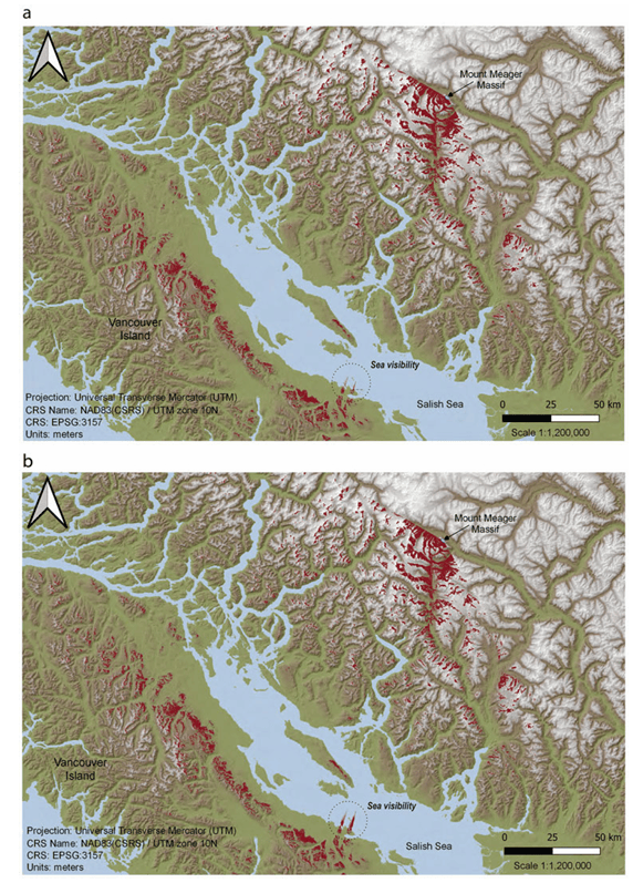
Implications for hazards and geothermal stewardship
The same structural framework that uplifted, fractured, and reduced Qwélqwélústen continues to influence fluid flow and slope instability today. Fault-controlled corridors and hydrothermally weakened rock masses remain capable of catastrophic failure, sometimes coincident with magmatic or hydrothermal unrest. These same structures also govern permeability relevant to geothermal development.
In short: geology and oral history tell a consistent story of a mountain still in motion. Listening to both strengthens hazard anticipation, geothermal evaluation, and respectful long-term planning with Líl̓wat leadership and downstream communities.
A personal note
When my structural analysis first suggested that Qwélqwélústen had lost roughly a kilometre of elevation, I trusted the numbers. Hearing an ancestral Líl̓wat voice say, “we could once see the ocean from there,” and watching a modern viewshed analysis independently recreate that vista transformed the work. Here, science and Indigenous knowledge are not in tension—they are complementary, convergent, and profoundly human.
Acknowledgments
This work was conducted on the traditional, ancestral, and unceded territory of the Líl̓wat Nation (Líl̓wat7úl). I thank Líl̓wat Elders and Knowledge Holders for preserving the histories that deepen understanding of Qwélqwélústen.
References

Mahmud Muhammad, Glyn Williams-Jones, and René W. Barendregt. 2024. Structural geology of the Mount Meager Volcanic Complex, BC, Canada: implications for geothermal energy and geohazards. Canadian Journal of Earth Sciences. 61(2): 158-186. https://doi.org/10.1139/cjes-2023-0077.

Note
For clarity of the scholarly record, I note that the structural and geomorphic reconstruction demonstrating substantial elevation loss at Qwélqwélústen was published prior to the appearance of the viewshed-based oral history analysis. That earlier work established the quantitative geological framework—specifically, kilometre-scale relief reduction—within which summit visibility could be independently evaluated.
It is also important to state that one of the co-authors of the later oral history study was fully aware of my findings at the time of its development, having served as my former PhD advisor and collaborator during the period in which this geological interpretation was produced and published. Despite this, the earlier geological work was not cited or acknowledged in that publication.
This note is offered not to diminish the value of interdisciplinary scholarship or Indigenous knowledge—both of which I strongly support—but to ensure accurate attribution of prior scientific contributions. Proper citation is essential for maintaining trust, transparency, and continuity across disciplines, particularly when independent lines of evidence converge on the same conclusion.
Leave a Reply