Geospectrum Solutions provide Expert Geological Support — Without the Expert-Level Price Tag
Expert Geological Support — Without the Expert-Level Price Tag
ABOUT
ABOUT
GeoSpectrum Solutions was founded to address a critical challenge facing the Canadian geological industry: high costs and limited availability of experienced, licensed geologists (P.Geo), and the underutilization of capable but unlicensed or early-career geoscientists.
Founded by Dr. Mahmud Muhammad — a Ph.D.–level geoscientist with extensive experience in remote sensing, geohazard monitoring, geological mapping, and computational geoscience — GeoSpectrum Solutions harnesses the best of academic research and field geology: rigorous data analysis, modern geospatial tools, and an adaptive, efficient mindset.
Our mission is simple: to deliver expert-level geological services and field support — at junior- to mid-level cost — helping clients meet exploration, geotechnical, environmental, and mining goals without overspending.
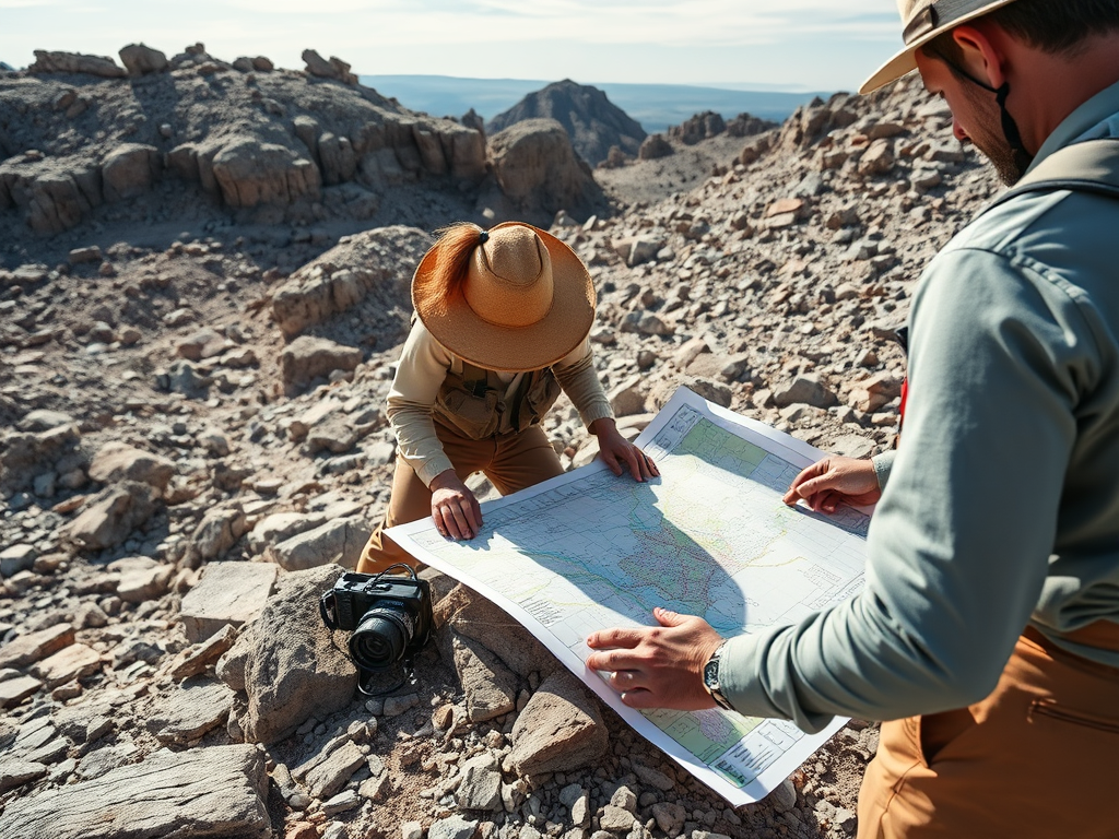
GeoSpectrum Solutions provides high-quality geological, geotechnical, and remote sensing support for exploration companies, consultants, and engineering teams.
We offer field mapping, core logging, geotech studies, hyperspectral analysis, GIS, and AI-driven data processing at affordable rates. Our role is to assist—not replace—client P.Geo/P.Eng professionals, who remain responsible for final decisions.
Rooted in research and academia, we deliver efficient, reliable expertise and skilled technical personnel.
Ready to get reliable field support without excessive cost?
Get accurate logs without hiring senior P.Geo staff full-time.
Geotechnical & Engineering-Geology Fieldwork
Rock-mass classification (e.g. RMR, Q-system), slope-stability assessments, soil/overburden logging, pit-wall characterization — useful for mining, environmental, or civil-engineering projects.
Hyperspectral & Remote Sensing Mineral Alteration Mapping
Using satellite imagery, UAV data, and advanced processing, we map mineral alteration zones and interpret mineralization vectors combining field experience with data-science workflows.
Flexible Field Staffing & Project Support
Need prospecting help, sampling, GIS/data-entry, or junior-staff training? Our research-trained personnel are ready to support exploration managers, consultants, or prospectors — no long-term commitment required.
At GeoSpectrum Solutions, we believe that the skills cultivated in academic research — critical thinking, efficient data handling, remote sensing, geospatial analysis, and mentoring junior staff — are enormously valuable for real-world geological and exploration projects. Over years of academic research, scientists are often asked to “do more with less” — delivering robust, publishable-quality results under tight budgets and time constraints.
We bring that same mindset to the field. Whether it’s core logging, mapping, or hyperspectral alteration studies, our workflows prioritize:
Scientific rigour and documentation — every observation, sample, and data product is carefully logged, georeferenced, and archived.
Efficient use of resources — we know how to maximize output per dollar, leveraging open-source tools, automated data pipelines, and streamlined field-to-database workflows.
Training and mentorship — we frequently work with junior-level personnel (GIT-level, early-career geoscientists), training them in best practices. This not only keeps costs down for clients but helps build the next generation of capable, well-trained field geologists.
Adaptability — just as in research projects, we adapt rapidly to changing project scopes, unexpected challenges, and evolving data requirements.
GeoSpectrum Solutions does not provide professional geology or engineering sign-off services and does not replace licensed Professional Geoscientists (P.Geo) or Professional Engineers (P.Eng).
Our role is to support your licensed professionals by collecting, processing, analyzing, and organizing geological, geotechnical, and remote-sensing data. All final interpretations, approvals, and regulatory sign-offs remain the responsibility of the client’s licensed P.Geo or P.Eng.
In mineral exploration, a 3D geological model is only as good as the geological data behind it. Leapfrog has revolutionized how we visualize subsurface geology, but the true strength of any model still depends on the quality of the geological data used to build it. When constructed properly—anchored in solid surface mapping and refined by…
“GeoSpectrum Solutions provides high-quality geological, geotechnical, and remote sensing support for exploration companies, consultants, and engineering teams. We offer field mapping, core logging, geotech studies, hyperspectral analysis, GIS, and AI-driven data processing at affordable rates. Our role is to assist—not replace—client P.Geo/P.Eng professionals, who remain responsible for final decisions. Rooted in research and academia, we…
Mount Currie in southwestern British Columbia represents a region of active geological processes and significant geotechnical challenges. My doctoral research, presented in Chapter 4 of this thesis (https://summit.sfu.ca/item/38467 ), integrates structural geology, satellite remote sensing, and geotechnical modeling to evaluate rock slope instability across this prominent landscape. This article offers a detailed review of key…
Something went wrong. Please refresh the page and/or try again.
Interested in Partnering With Us?
We welcome collaboration with consulting firms, technology companies, and geoscience service providers who share our commitment to innovation, data quality, and practical field solutions.
If your company is interested in partnership opportunities—including subcontracting, joint projects, training, or technology integration—please reach out.